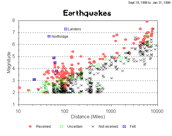
Since bringing my seismometer online in September, 1996, I have detected over a hundred earthquakes. However, there have been about four times that many that I have looked for but not recieved. They have all been too small, too far away. By plotting the distance and magnitude of each earthquake on a graph you can see that there is a clear separation between quakes recieved and not received.
For a given distance, there is a certain magnitude that the quake must have in order for me to recieve it. I have included the Northridge and Landers earthquakes for comparison with the other events, even though they happened before I had a seismometer.
Here is an explanation of the labels:
You may have noticed that there are some local earthquakes marked as 'Not Received' in an area where they should have been received. These are older earthquakes, and this is caused by the fact that I recently upgraded my system to a higher sampling rate. Now the Lehman responds much better to higher frequencies and consequently records more local quakes.
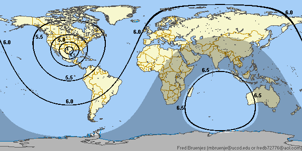
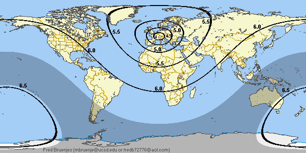
From the above chart, I determined the various maximum distances at which I could receive an earthquake of a particular magnitude. For example, you can see that a magnitude 5.0 quake will only be detected if it is less than about 1,300 miles away. I then drew a line on a world map indicating 1,300 miles of distance from my house. Repeating this with other magnitudes, I arrived at the following map:
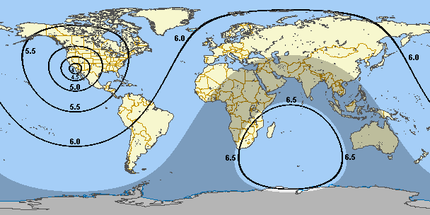
So I can detect a magnitude 5.0 earthquake that hits anywhere in the western United States. But I won't get one that hits in the eastern part. An interesting thing is that I can get a magnitude 6.5 quake essentially anywhere in the world, except for a small blind spot covering the Indian Ocean. The shaded area is the 'shadow zone': the P waves of earthquakes ocurring in this region will not be received due to refraction in the Earth's core.
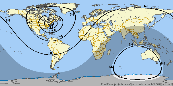
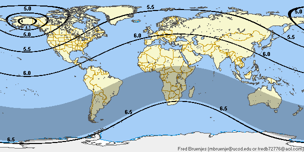
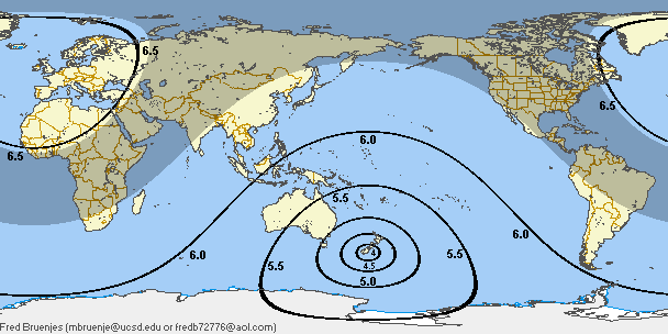
I have constructed similar maps for people located in other parts of the world:
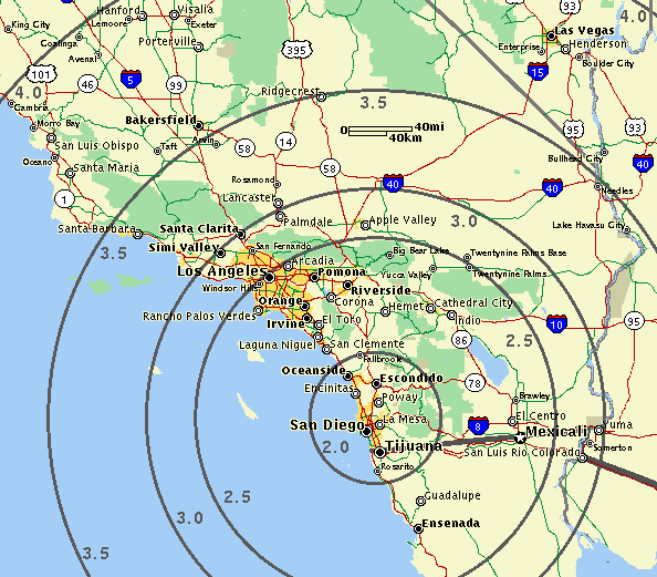
I then repeated the above procedure for local earthquakes on a California map. This map is most useful to me, but it should give you an idea of the Lehman's capabilities with respect to local earthquakes.
For those that are interested, here is the data I extracted from the distance vs magnitude plot:
Magnitude:  Distance:
----------  ---------
   2.0          40 mi
   2.5         110 mi
   3.0         140 mi
   3.5         200 mi
   4.0         300 mi
   4.5         700 mi
   5.0       1,300 mi
   5.5       2,500 mi
   6.0       4,500 mi
   6.5      10,000 mi
   7.0+  Anywhere on Earth
By 'distance' I mean the maximum distance at which the effects of the quake can be seen by a standard Lehman-style seismometer in the middle of a large city (in my case, San Diego). People in quieter locations, or with better equipment, can expect to do better.
It is important to note that these are approximate positions. Various factors will combine to cause some quakes outside the circles to be detected, and others within the circles to be missed.
From here, you can go back to the main quake page.
Or check out my home page.
Comments? Questions? Click here to send email to me, Fred Bruenjes.
All text and images are © 2001 Manfred Bruenjes - All Rights Reserved. Image inlining is strictly prohibited. Email for permission before using an image or text.